Deal of The Day! Hurry Up, Grab the Special Discount - Save 25% - Ends In 00:00:00 Coupon code: SAVE25
Esri Exam EADE105 Topic 6 Question 1 Discussion
Actual exam question for
Esri's
EADE105 exam
Question #: 1
Topic #: 6
[All EADE105 Questions]
Topic #: 6
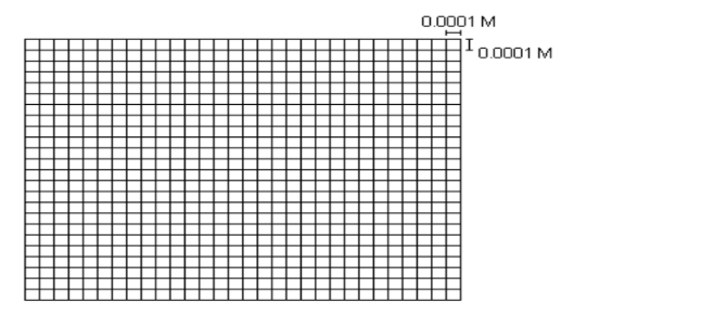
Refer to the exhibit.

The exhibit below provides a conceptual view of a coordinate grid onto which all coordinate values snap to the grid mesh The grid covers the extent of each dataset An ArcGIS user is creating a new feature class, and needs to increase the numeric precision used to store the coordinate values
When modified, which of the following will increase the numeric precision used to store the coordinate values?
Currently there are no comments in this discussion, be the first to comment!